Latitude, Longitude: 36.0529 , -112.08304 Elevation: ~7260ft (at South Kaibab trailhead)
Elevation varies from 7260' at South Kaibab Trailhead to 2546' at Phantom Ranch to 6860' at Bright Angel Trailhead (according to NPS websites)
Weather Forecast: Grand Canyon Village Weather Forecast
Fire Restrictions: See the Grand Canyon National Park site |
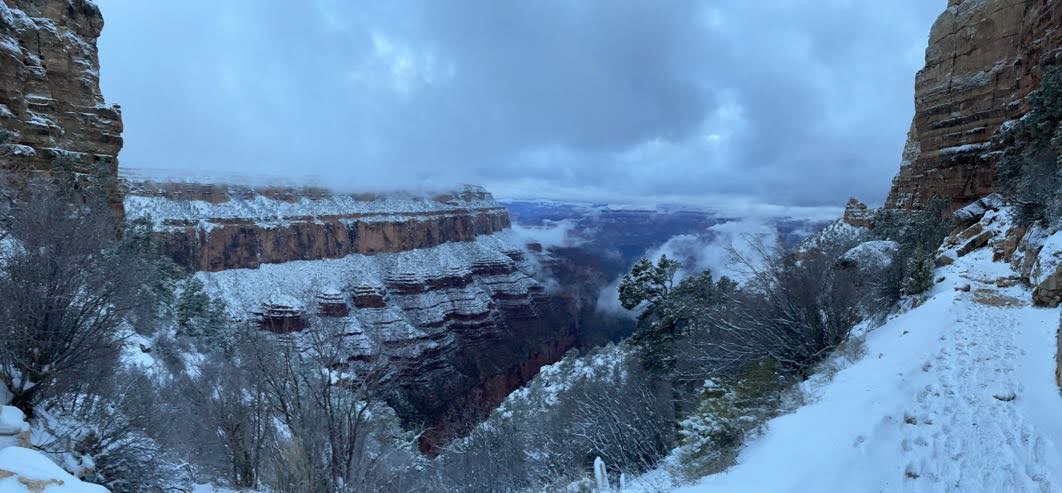
| View from Skeleton Point, Grand Canyon (photo by Dan Lafferty) |
Intro
Here we are with yet another out-of-state blog on my New Mexico camping blog. Well, this one is just because the Grand Canyon is epic and deserves another spot on the web to showcase some beautiful pictures. We often try to get a more adventurous trip for the older (14-18) teenage boys in our church youth group, something with sufficient challenge to help them appreciate that they can accomplish great things with sufficient preparation and hard work. In planning our options for 2023, one of the young men suggested the Grand Canyon. We (I?) might have initially scoffed at that, but once one of our leaders started looking into it, we realized it was doable. I'll also convey some of the preparation information, which honestly, is even more important for this than it was for the 4 Pass Loop.
Resources
Do your homework; be prepared. Honestly, the National Park Service does an excellent job of making appropriate resources available. We scoured for planning resources, but ultimately, we got pretty much everything we needed off the NPS website itself. It really is well done.
Grand Canyon National Park website: Grand Canyon National Park (U.S. National Park Service) (nps.gov)
Specific NPS page about distances and elevations of various parts of the Grand Canyon Adventure. Backcountry Trail Distances - Grand Canyon National Park (U.S. National Park Service) (nps.gov)
Webcams from NPS page. Super helpful when you are looking to evaluate trail conditions. Webcams - Grand Canyon National Park (U.S. National Park Service) (nps.gov)
Critical Alerts and Backcountry Updates: Critical Backcountry Updates: Including Trail Closures and Restrictions - Grand Canyon National Park (U.S. National Park Service) (nps.gov)
Alltrails Description of this same route: Explore South Kaibab, Phantom Ranch, and Bright Angel Trail | AllTrails
Gear Rental available nearby: Camping & Hiking Gear Rental | Grand Canyon Outfitters (visitgrandcanyon.com)
Preparation
All over the NPS pages and on other blogs around the web, you will find abundant warnings telling people not to do exactly what we did on this trip. They glaringly say, "DO NOT, under ANY CIRCUMSTANCES, attempt to hike from Rim-to-River-to-Rim in a single day." (referring to leaving the South Rim, going to the bottom, then back up to the South Rim) They are even more strenuous in condemning such an attempt to go "Rim-to-Rim" (from the South Rim to the River and on to the North Rim; or vice versa). That is very good advice, but there are exceptions. Keep in mind, the NPS must put out such warnings for the lowest common denominator, for the average person with no experience who shows up on a Tuesday morning at the Grand Canyon and thinks, "Wow. This is beautiful. I've gone on a 2 mile hike before; I'm just going to do this today and be back before nightfall." People have tried such things without preparation, and sometimes they do fine - but sometimes (often) they end up injured or even in the hospital. I won't link to the numerous stories here of people who ended up with serious health issues/accidents in the Grand Canyon; feel free to google that yourself. Preparation is the key. Weather is your worst enemy here. If you show up in the Grand Canyon in June or July, those 120F temperatures at the base of the canyon are going to eat your lunch, fry your brain, and leave you seriously dehydrated or worse. I know there have been some that have done this trip successfully in the summer, but they are the exceptions.
We went in mid-March, and it was great. Even though it was around 20F in the morning and snowed multiple inches the night before, it was still around the 70s at the bottom (4hrs later) and very sunny. Sunscreen was required, and lots of water. We had planned our trip for months in advance and knew how much water we'd need, planned to have enough calories for the trip (I brought way too many), and had carefully planned out the route we were taking, including planning our departure and anticipated arrival times relative to shuttle bus availability.
For preparation, I will note that the AllTrails link above was very helpful. The NPS sites have lots of good information, and the webcams are super helpful, but the AllTrails page gets new comments often (sometimes multiple times per week) where people will often comment on the trail conditions, water availability, etc. I found that very helpful.
Conditioning: You don't need to be a marathon trail runner to do this trail successfully, but you do need to be experienced in hiking. You need to be familiar with your limits and know yourself well enough to be able to push through a long, difficult hike. Because, once you get down there, hiking up is the only way out. We had 13-14yr old boys with us, but they are all active and regularly participate in soccer or other sports, so they had no problems physically. A few of us were quite a bit slower, but we had been on enough long-distance backpacking trips to know we could do this - especially as a day hike without the extra weight of overnight gear. But, please don't attempt this if you don't have sufficient experience.
Route planning: most people will head down South Kaibab and back up Bright Angel. There's a reason for that. SK is a bit steeper, and there is zero water available along SK. You have water at the trailhead and down at Phantom, and that's it. I mean, I guess you could filter from the river, but at that point, you're less than a mile from the Ranch with clean water. Coming back up BA, we at least had water at the Gardens, but during the summer months, you'd also have water at the 3mi and 1.5mi rest houses. That's the route we took, SK to PR to BA, and I would do it that way again.
The Trek
We started at 6am and went approximately 6 miles down to the river, then another mile or so to Phantom Ranch. The hike down South Kaibab is pretty steep at times, and since the return on a standard hike (hike up a mountain, and return coming back down) is so much faster than the way up, I figured we'd make really good time on the way down.
 |
| South Kaibab trail conditions at 6am (photo by Jeff Dabling) |
I was warned it probably wouldn't be so, but I didn't see how it could be otherwise. I don't know if the trail conditions for the first several miles had something to do with it, but while I was thinking we maybe do that 6 miles in 3hrs or less, it took me more like 4hrs or so. Especially since we were doing a day-hike without the need to carry 40-lb backpacks, I figured it wouldn't be that big of a deal. It was slow going with the icy trail to start, then slushy, then muddy, then damp. Maybe we were tired after that... but it took time to get down. Don't underestimate that.
 |
| Tunnel leading to Kaibab Suspension Bridge, at the Colorado River (photo by Jeff Dabling) |
 |
| Kaibab Suspension Bridge (Black Bridge), on the Phantom Ranch side (photo by Gary Fears) |
We got down to Phantom Ranch and took a break for lunch. I checked my boots and decided to apply a little moleskin to make sure some hot spots didn't turn into full blisters. Applied more sunscreen. Rested a bit, refilled my hydration reservoir, then got going. We were on the move again by 11am. We had 10 miles to go, and a lot of elevation in those miles! Honestly, while I was a bit tired at this point, I felt pretty good. I didn't have any issues and knew I was still good for multiple more miles.
The next major stop would be Havasupai Gardens (formerly Indian Gardens), approximately 5 miles away. That would also be the next water station. The trail starts out relatively level for the first two miles or so out of the Ranch before it starts going back up the canyon (around Pipe Creek Beach). Once you get hiking up the canyon a bit, you get to a region I was told was called the Corkscrew - a series of switchbacks and twists and turns before you hit the straight-away leading to the Gardens.
Getting into the Gardens, I was tired. I had done around 12 miles by that point in the day. But, I was still feeling good. I felt like I could keep going, and even do this again the next day. We got some water, took a break. Had some more snacks. I was a bit motivated by the fact that while I had been planning on another 5 miles from the Gardens to Bright Angel Trailhead, the signage at the Gardens clearly said it was 4.5 miles remaining. Sometimes it's the little things.
Time to finish this off!
From Havasupai Gardens, with 4.5 miles remaining, there are 2 additional checkpoints at 3 miles from the top and 1.5 miles from the top. These checkpoints are creatively named the "3 mile rest house" and the "1.5 mile rest house". Knowing that my progress would be easily trackable gave me a lot of assurance (at about the Gardens, I had to turn off the GPS tracking on my phone for AllTrails because it was sucking my battery dry! I wanted to make sure I still had battery for taking pictures, so no more digital GPS from this point; I was down to 25% battery). I was also pleased to look at my timing and realize it was feasible that I could get back before dark and possibly have a chance of a decent dinner! Up until then, I was thinking it might take me 15 hours to complete this, putting me back up top around 9pm. Now, it was looking possible that I might be back hours before then. That was good news.
I hit the 3 mile checkpoint and still felt pretty good. Obviously, I was tired. But, I felt good. No water refill available, but I had plenty. The trail was still in good condition. But, about the 1.5 mile checkpoint, something switched in me, and my body said I had enough. I was dead tired. It didn't help that around this point, the trail started to get snow/ice covered again, which takes a lot more energy to hike over. More energy is wasted as there was a fair amount of slipping. Mostly due to this, I decided to put on my ice spikes at some point around 1-1.25 miles remaining. It's a bit of a trade-off, as it's harder to walk with the spikes, but each step is much more efficient. So, I was better off with the spikes on at the end, but it was still more tiring than hiking a dry trail without spikes.
 |
| Snowy/Icy for the last mile or so to Bright Angel (photo by Jeff Dabling) |
After 12hrs and 40 minutes, I made it to the top of Bright Angel! Woot! It was great! Several members of our group made it in around 9 hours, but I was pretty happy with my time. We got back just in time to head to a nearby town to get some real dinner! No mountain house meals for me that night!
I'd be interested to do this trek again, but I'd like to try it as a 3-day backpacking trip. It seems like a good itinerary would be to take the first day hiking down to Phantom Ranch from South Kaibab. Tent camp down there (permit required). 2nd day, hike up to Havasupai Gardens and then camp there. Last day, hike out the last 4.5 miles to the top of Bright Angel. It would be nice to spend more time in the canyon, and breaking up the hike out into two days would make it much more doable.
Transportation in the Village
Something to consider is how to get where you are going. The Bright Angel Trailhead is pretty accessible as it sits amongst the main part of the shops and museums and such of Grand Canyon Village. There are shuttle stops nearby, but also parking, so you can come and go as you please. South Kaibab has no parking - you can only get to it by shuttle bus. So, you need to plan your route such that you can go when the shuttles are running. We were able to make it work by planning on having some of the faster crew finish up early enough to still be able to take a shuttle back from Bright Angel to South Kaibab, pick up a car that we had left at SK that morning, and then come back in that vehicle to pick up the rest of us. Keep in mind, that round-trip with the shuttle and then driving back took our team member the better part of an hour! The shuttles make lots of stops.
Drinking Water & Food
Water is life. Hydrate or die. Know where you are getting your next water from and plan accordingly. Know how much water you need in case your next refill point is unexpectedly unavailable. We had grand plans of just carrying a few liters of water down to Phantom Ranch, and then only carrying maybe 2 liters to the Gardens, and from there, 1 liter in between each rest house. Great way to save weight. Problem is, per the link below, the 3mi and 1.5mi rest house water was closed for the winter when we went in March. Only water between Phantom and Bright Angel Trailhead was at the Gardens. So, I hiked with my full 3L reservoir plus a backup Nalgene. I actually drank the Nalgene first, as that is where I mixed in my electrolytes. Regardless: make yourself knowledgeable about what water is available, have a backup plan, and be prepared.
Critical Backcountry Updates: Including Trail Closures and Restrictions - Grand Canyon National Park (U.S. National Park Service) (nps.gov) (look for the heading on drinking water in the cross-canyon corridor)
As it turns out, I only consumed 1.5L of water (with 2 Propel packets) from SK down to Phantom. Whatever I might have drunk at lunch, once I filled up there, I only drank another 1.5L (and 2 Propel packets) until the Gardens. And, after the refill at the Gardens, I did about 1.75L (and 2 Propel packets). But, everyone is different. I am glad I had the water available. This was the first hike I tried the Propel packets. I don't actually like flavored water; I only took them because someone suggested the electrolytes would help me maintain endurance from all the "stuff" you lose when you sweat. I did it, and I feel like I did pretty good for most of the hike, so maybe it was helpful.
For food, I brought quite a bit more than I normally would have, but given experiences of others, I wanted to make sure I had enough. I ended up consuming:
- ~150 cal of peanut M&Ms
- one half of a mint power pro crunch bar (~160 cal)
- a 210 cal beef jerky stick (it was huge)
- 2 honey stinger waffles (160 cal ea)
- Lunch: 2 pulled pork packets (from Walmart, no refrigeration needed, 130 cal ea) with 1 tortilla (210 cal)
Water Crossings & Adverse Trail Conditions
I did enjoy the fact that there are no water crossings on this route that required getting your feet wet (but you do cross the river several times on bridges). Note that some other trails in the Grand Canyon do require crossing rivers, but not these.
Anticipating icy trails, I brought micro-spikes. I also brought hiking poles. I hadn't ever done a long trip with poles before, as I figured it was just extra weight. But, knowing there would be a lot of steps on this trail (lots!), and hearing that they are uneven in height with some as much as 18" (not common), I thought the poles would help me unload my legs and especially help if the trail was wet or icy. I could have maybe done without the spikes, although I'm glad I took them, but I definitely wouldn't do it without poles. I really enjoyed them. I think I will take them on all future backpacking trips or extended day trips like this. Look to the webcams (linked above) and the comments on the AllTrails link to evaluate your trail conditions and see what you might feel like you need.
Weather
I was told to expect a 30F difference between Rim temperatures and River temperatures. For us (in March), it might have been more like 40-50F, as it was around 20F when we started, and it felt like it was in the 70s when we got to Phantom Ranch. In the summer, it may be different; but keep in mind there is nearly 5000' elevation difference from the Rim to the River (depending on where you are on the Rim).
With those temperatures, I was worried about needing extra layers and then needing to pack those layers out, carrying dead weight. I didn't have one of those nice compactible puffy jackets or some other extra lightweight layer. So, I just started out wearing long pants and a long-sleeve Columbia PFG shirt, and a hat, of course. I did take a pair of lightweight gloves and balaclava in my pack, just in case, but I never needed them. It was admittedly chilly waiting for the shuttle bus in the morning, but the moment we started hiking, I was just fine. I'm certainly glad I wasn't carrying any significant weight for extra warmth. But, everyone is different - some people will need extra layers.
If you go in the summer, expect brutal daytime temperatures. I've spoken to several people that therefore intentionally started the hike in the summer at 11pm or midnight, trying to finish up by 7-9 am. I've spoken to some who did the trip in early Jan, and often snow isn't as much of an issue there, although I'm sure the overnight lows are still cold - but they didn't have to worry much about the trail condition at all. Whenever you go, just do your homework and plan accordingly.
Photos (in chronological order)
 | ||||||
Our campsite at Mather Campground, the night before our trek (photo by Gary Fears)
|


 |
| Getting on the shuttle bus to South Kaibab Trailhead at 5:30am (photo by Gary Fears) |
 |
| Starting out the morning on South Kaibab Trail at 6am (photo by Gary Fears) |
 |
| South Kaibab Trail a bit before Cedar Ridge (photo by Gary Fears) |
 |
| Misty Morning at Cedar Ridge (photo by Gary Fears) |
 | ||||
Me at Cedar Ridge (photo by Ray Griffith)
|


 |
| Skeleton Point (photo by Gary Fears) |
 |
| View of the canyon past Skeleton Point (photo by Jeff Dabling) |
 |
| Coming down off Skeleton Point (photo by Gary Fears) |
 |
| Early view of the Colorado River (photo by Gary Fears) |
 | ||
View of the Kaibab Suspension Bridge (Black Bridge) from above (photo by Gary Fears)
|

 |
| Crossing back over the Colorado on the Silver Bridge (photo by Jeff Dabling) |
 |
| Coming up the trail towards Havasupai Gardens (photo by Jeff Dabling) |
 |
| View of the canyon walls coming up Bright Angel (photo by Jeff Dabling) |
 |
| Looking back down the Bright Angel Trail, in between the 3 and 1.5 mile rest houses (photo by Jeff Dabling) |
 |
| Looking down at Havasupai Gardens and Plateau Point from just before 1.5mi rest house (photo by Jeff Dabling) |
 |
| View from the tunnel near the top of Bright Angel Trail (photo by Steve Meredith) |
 |
| View of the canyon from the top of Bright Angel Trail (photo by Jeff Dabling) |
No comments:
Post a Comment
Thanks for commenting!